Keywords:Mangere, island, chatham, islands, reserve, conservation, wilderness, sanctuary, douglas, basin, little
Photo Info
Dimensions7087 x 4724
Original file size16.4 MB
Image typeJPEG
Color spaceAdobe RGB (1998)
Shooting Conditions
Camera makeNikon
Camera modelNikon COOLSCAN V ED
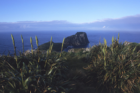
Flax to Little Mangere
Looking across main Mangere Island over Douglas Basin, over to Little Mangere Island. Mangere and nearby Little Mangere are the eroded remains of an ancient volcano of pliocene age. The island's highest point, Whakapa, is 292 metres above sea level.
Forested until the 1890s, Mangere Island was largely cleared for sheep grazing and farmed until 1966 when it was purchased by the New Zealand government and gazetted as a Nature Reserve. The last sheep were removed in 1968 with following effort to restore the flora and fauna. Several endemic Chatham Island bird species have since been reintroduced to the island including; Chatham Island Snipe, Black Robin, Chatham Island Tomtit and Shore Plover.