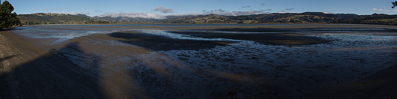
Blueskin Bay is an estuary in coastal Otago, about 20#160;km north of Dunedin. The name also unofficially describes the rural district which includes the northern slopes of Mount Cargill, the southern slopes of the Kilmog, and the townships of Doctors Point, Waitati, Evansdale, Warrington, and Seacliff.br/br/The tidal lagoon as seen here is known in Māori as Waiputai. The Waitati River and Careys Creek enter the Blueskin Bay lagoon at its southwest and northwest corners. A long sand spit from the northern headland closes the bay to a small channel to the Pacific Ocean at the southeast corner. The area is popular for gathering clams, locally known as quot;cocklesquot;.