Keywords:new zealand, lake, lake hauroko, fiordland, fiordland national park, south island, deepest lake
Photo Info
Dimensions6064 x 1819
Original file size8.21 MB
Image typeJPEG
Color spaceAdobe RGB (1998)
Date taken21-May-11 10:21
Shooting Conditions
Camera makeCanon
Camera modelCanon EOS 5D
FlashNot fired, compulsory mode
Exposure modeManual
Exposure prog.Manual
ISO speedISO 100
Metering modePattern
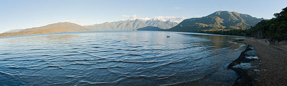
Lake Hauroko panorama 1
Lake Hauroko is located in a mountain valley in Fiordland National Park in the South Island of New Zealand. The long s-shaped lake is 40 kilometres in length and covers an area of 63 km#178;. The surface is at an altitude of 150 metres above sea level, and the lake is 463 metres deep, being New Zealand's deepest lake.br/br/ One of the country's southernmost lakes, it is 35 kilometres northwest of Tuatapere, between the similarly-sized lakes Monowai and Poteriteri. It drains via the 20 kilometre-long Wairaurahiri River into Foveaux Strait.