Keywords:New Zealand, otago, harbour, peninsula, scene, landscape, view, vista
Photo Info
Dimensions7087 x 2953
Original file size3.15 MB
Image typeJPEG
Color spaceAdobe RGB (1998)
Date taken25-Oct-12 11:19
Shooting Conditions
Camera makeCanon
Camera modelCanon EOS-1D Mark IV
FlashNot fired, compulsory mode
Exposure modeManual
Exposure prog.Manual
ISO speedISO 100
Metering modePattern
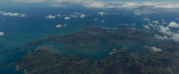
Otago Peninsula
The Otago Peninsula viewed from a jet plane as it veers around to the north.br/br/The Otago Peninsula is a long, hilly indented finger of land that forms the easternmost part of Dunedin, New Zealand. Volcanic in origin, it forms one wall of the eroded valley that now forms Otago Harbour. The peninsula lies south-east of Otago Harbour and runs parallel to the mainland for 20#160;km, with a maximum width of 9#160;km. It is joined to the mainland at the south-west end by a narrow isthmus about 1.5#160;km wide.