Keywords:New Zealand, southland, toetoe, bay, estuary, landscape, lagoon, fortrose
Photo Info
Dimensions5294 x 2206
Original file size1.39 MB
Image typeJPEG
Color spaceAdobe RGB (1998)
Date taken24-Oct-14 19:56
Shooting Conditions
Camera makeCanon
Camera modelCanon EOS 5D
FlashNot fired, compulsory mode
Exposure modeManual
Exposure prog.Manual
ISO speedISO 100
Metering modePartial
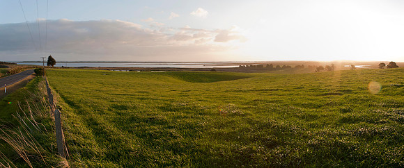
Sunset view to Fortrose estuary
Panoramic view looking across the fields to Fortrose estuary. Fortrose harbours a lagoon and is near the mouth of the Mataura River on Toetoes Bay, in Southland's south-east coast.br/br/Fortrose was first established as a whaling station in 1834. At this time Fortrose was known as Russeltown. The name was later changed to Fortrose by a Scotsman who claimed that the area was like Fortrose in Scotland. By 1875 Fortrose had become a very busy port with a new jetty being built that year and its main living was made out of exporting wool, grain and timber. However Fortrose’s prosperity ended when the railway line was opened in 1899.